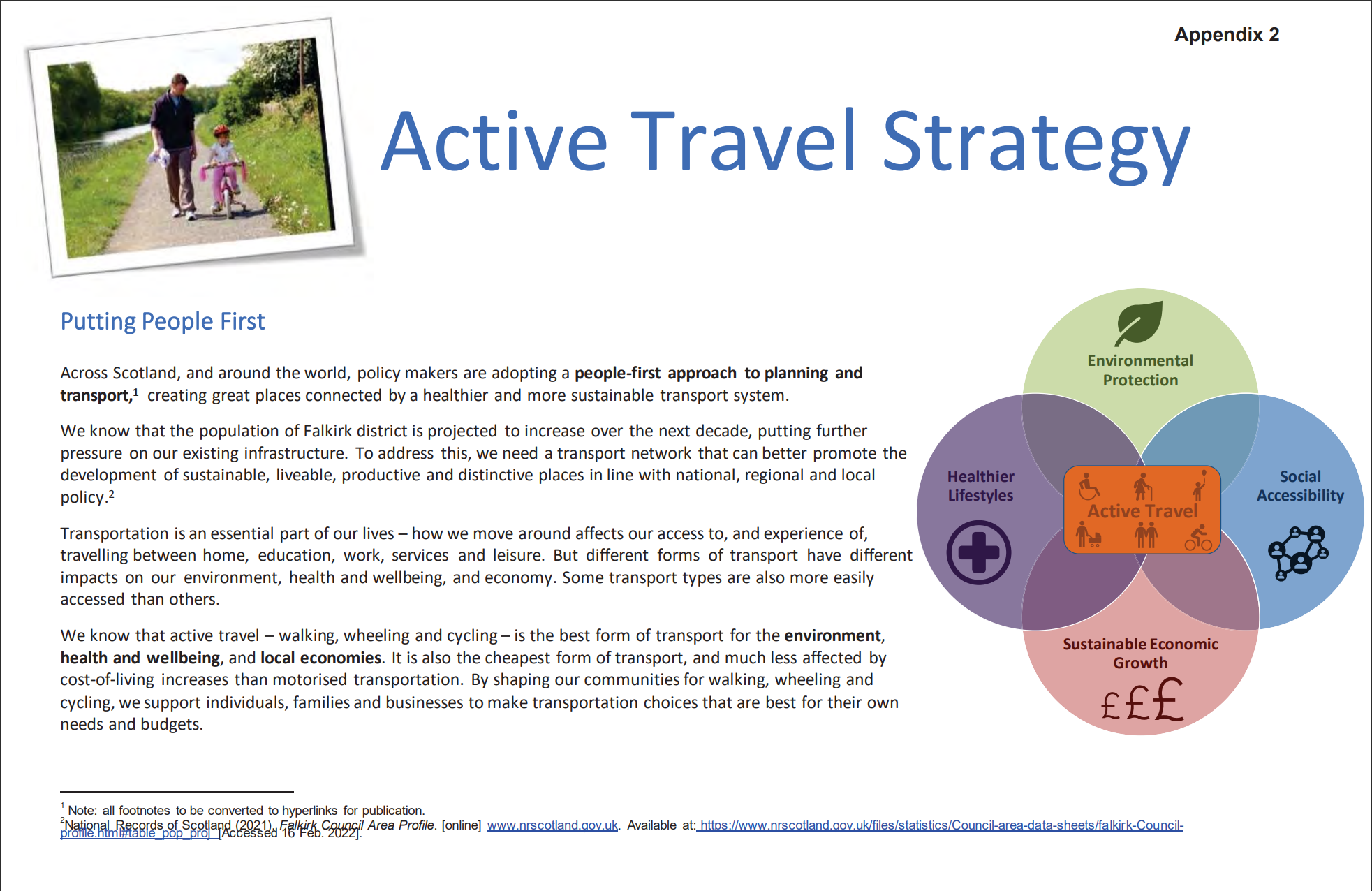
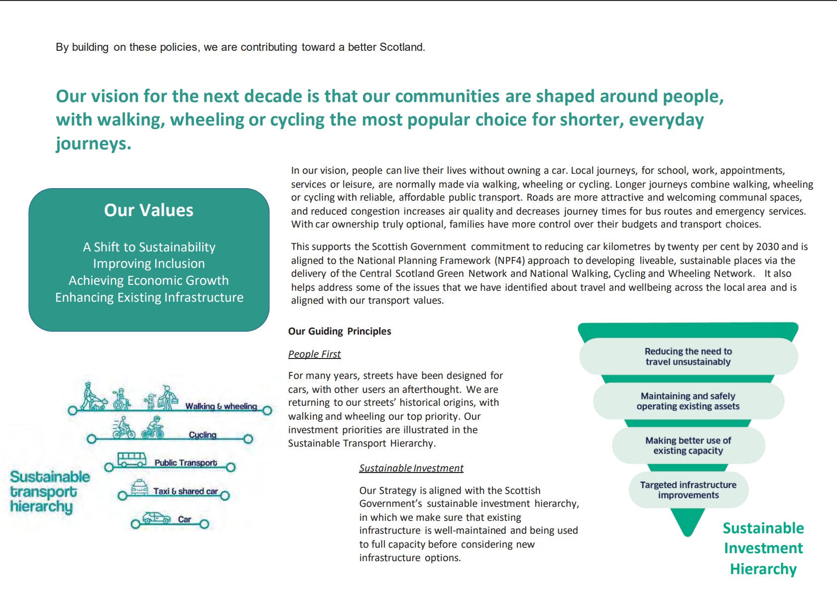
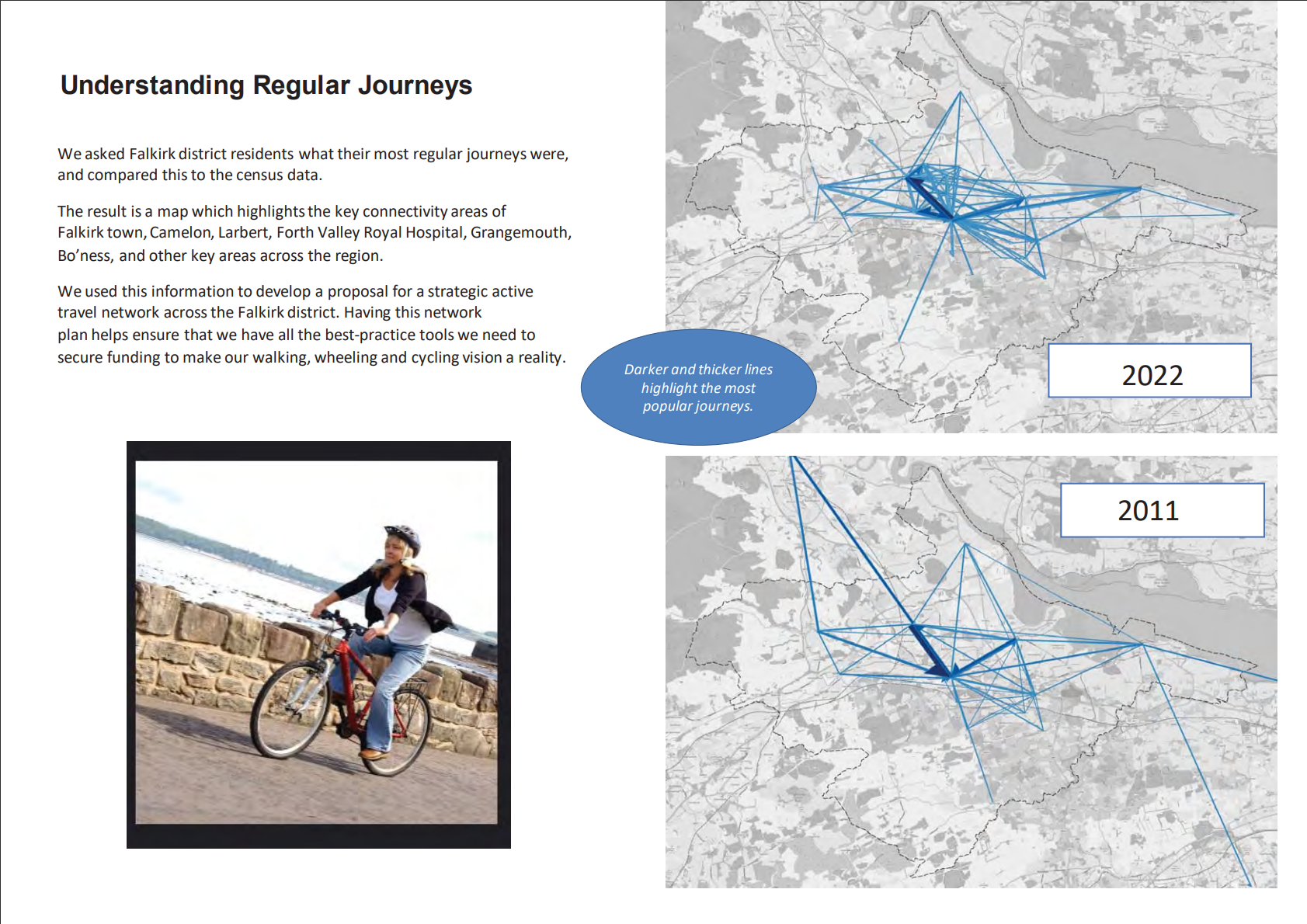
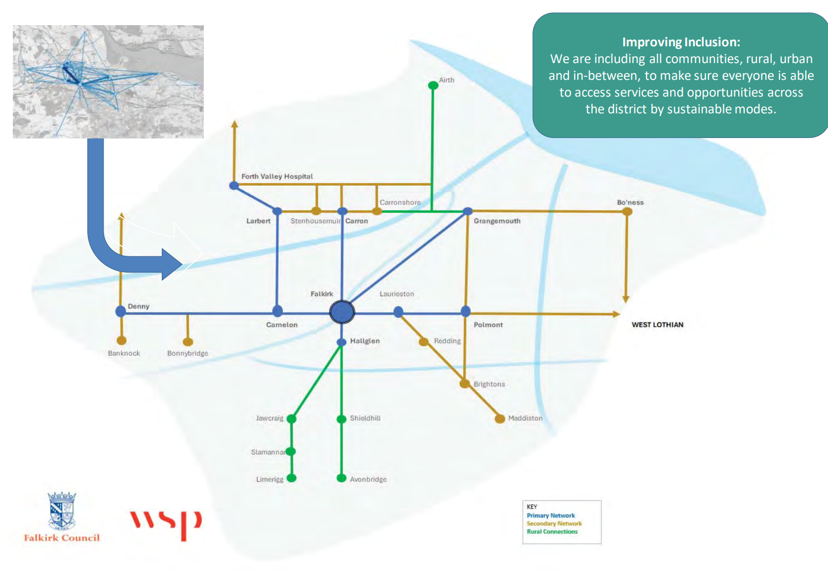
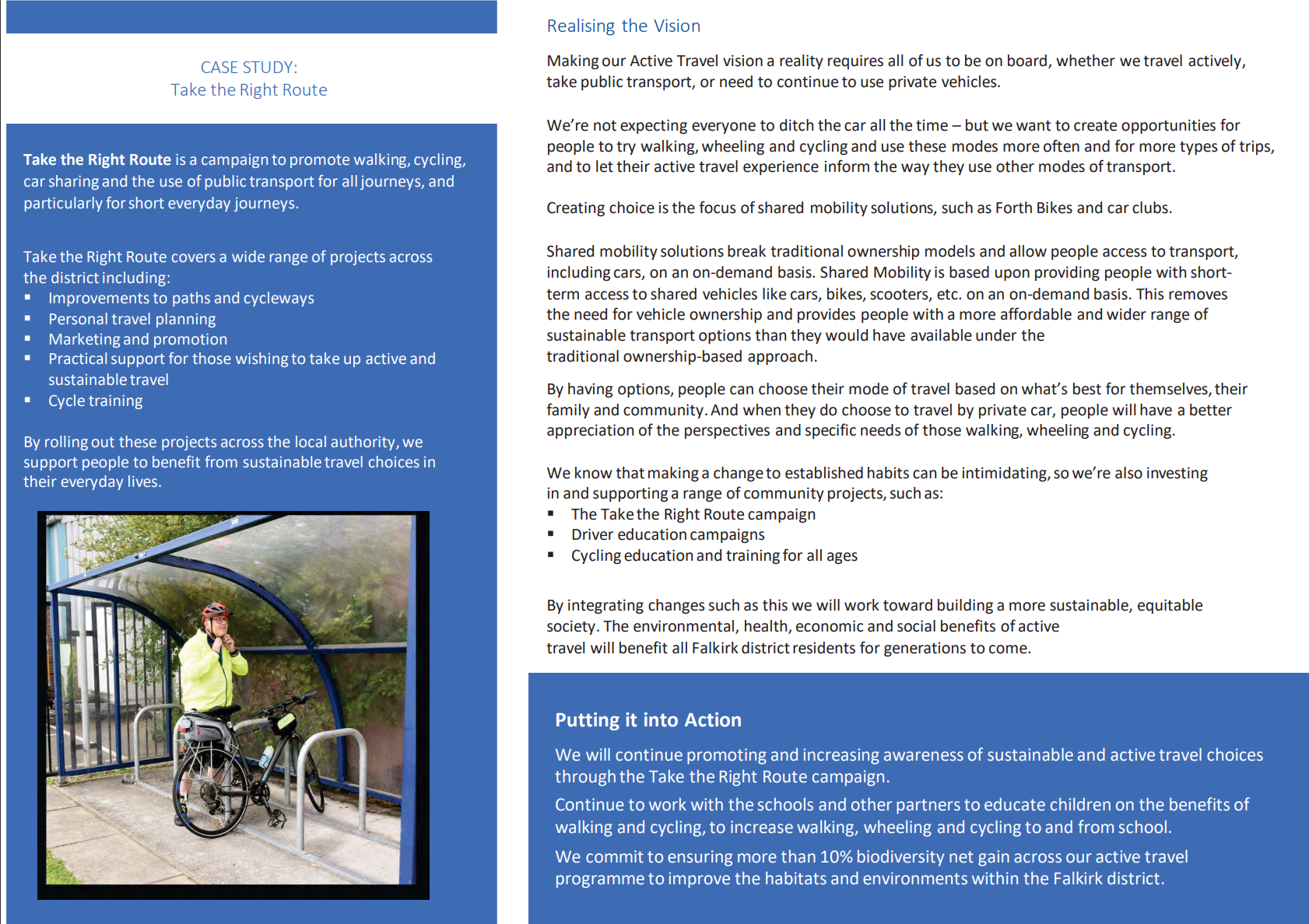
This is the Falkirk Council Active Travel Strategy.
It can be found here: https://www.falkirk.gov.uk/coins/viewDoc.asp?c=e%97%9Dc%91k%7B%8D

Please take some time to read it and consider what it might mean for you.

A presentation slide titled 'Active Travel Strategy' with a photo of an adult and a young girl riding a bike on a path near a river, and a colorful diagram showing the benefits of active travel including environmental protection, healthier lifestyles, social accessibility, and sustainable economic growth.
Diagram showing Falkirk's active travel strategy, including local and regional transport plans, climate emergency action plan, air quality management, and economic growth strategies, with icons representing various transportation modes and policies.
Diagram illustrating the sustainable transport hierarchy, showing from top to bottom: reducing the need to travel unsustainably, maintaining and safely operating existing assets, making better use of existing capacity, and targeted infrastructure improvements with a green triangle at the bottom labeled 'Sustainable Investment Hierarchy'.
A document outlining goals and strategies for developing walkable, cycling, and wheel-friendly communities, focusing on thriving communities, a growing economy, and sustainable places, with key priorities such as raising awareness, supporting road users, investing in infrastructure, and ensuring accessible neighborhoods.
Diagram listing transportation challenges in Falkirk district, including older population, antisocial behavior, air quality, regional hilliness, lack of car access, rising living costs, traffic congestion, and new settlements, with suggested solutions.
A two-page document discussing community development projects in Falkirk, including trails, monuments, sculptures, and infrastructure for walking and cycling, with a small photo of people at night participating in a community event.
Map illustrating walking and cycling distances in Falkirk, with concentric ovals showing 400m, 2400m, 5km, and 10km zones. Text box emphasizes accessibility and infrastructure for active travel.
Map with five sections highlighting different areas around Falkirk, Scotland, including Bo'ness, Grangemouth, Falkirk, Denny, and Larbert and Stenhousemuir. Each section lists walking, wheeling, and cycling routes and distances to nearby landmarks and amenities.
A page from a report explaining the most popular journeys in Falkirk district in 2011 and 2022, with maps showing the routes, and a photo of a woman riding a bicycle along a riverside path.
Map of Falkirk area showing transportation network with primary and secondary routes, including community connections, and emphasizing inclusive access across rural, urban, and in-between areas.
A person riding a bicycle on a designated bike lane along a street, with a bus and a person walking nearby, in an urban area with trees and a stone wall.
Diagram showing a typical existing urban parking situation. It includes footways on both sides of the street, a carriageway with parking spaces, and on-street parking in the middle. There are pedestrians walking on the footways and cars parked in designated spaces. Buildings are shown on both ends of the street.
Diagram showing future transportation network with expanded footways, carriages, safer cycle facilities, increased capacity, and kerb-protected cycle track.
Diagram showing a typical existing secondary network with labeled footway, on-street parking, carriageway, and footway at each side, with cars parked on the street, and pedestrians walking with a dog.
Diagram illustrating future changes to a parking lot and surrounding area, including footways, protected cycle tracks, a carriageway, shared car club parking, and green spaces with trees and plants.
Diagram labeled 'Rural Network - Existing Situation' showing two cars on a gray road, with green verges on either side. Carriageway is in the center, with arrows indicating the direction of traffic.
Diagram illustrating future transformation of rural networks, showing a road with two lanes for cars and a separate off-road path for pedestrians and cyclists, with labels indicating more trees, new facilities for walking, wheelchairs, and cycling.
A map of Falkirk District showing a network of paths for walking, cycling, and wheeling, with accompanying text about investments, improvements, and strategic plans for the travel network.
A group of four young people walking down a paved street in front of a white historic building with a clock tower, surrounded by green trees and a blue sky with some clouds.
A bustling pedestrian street scene with bicycles parked in the foreground, shops, pedestrians, and a church steeple in the background.
Two photographs of people engaging in active transportation. The left photo shows a woman riding a bicycle at a crosswalk near a building. The right photo shows a woman walking on a sidewalk with crutches in a residential neighborhood.
A page of a report discussing transportation and infrastructure projects in Falkirk, including investments in cycling, walking, cargo bike facilities, and accessibility improvements.
A newsletter or report page with a photo of two children walking on a school pathway, section headings such as 'Creating Liveable Neighbourhoods', and a case study about biking and walkability in Scotland. There is also a green box with information about promoting independence and an adjacent blue sidebar with additional details.
A page from a report or brochure discussing cycling paths and community engagement, featuring two photos: one of two women walking on a trail surrounded by greenery, and another of people, including children, cycling in a park with sculptures and flowers.
A person riding a bicycle with a basket on the front, wearing a helmet and safety vest, on a paved path in what appears to be a suburban area with houses and trees in the background.
A community brochure discussing sustainability initiatives in Falkirk, Scotland. It highlights active transportation options like electric bikes and shared mobility programs, with a photo of a bike-sharing station with several e-bikes.
A person in a yellow jacket with a red helmet standing next to their bike at a bike rack inside a shelter, with greenery in the background.
A page of text describing Falkirk Council's active travel initiatives, including support for school travel, behavior change projects, infrastructure investments, and a side panel with a photo of Helix Park and Kelpie sculptures, along with an event where 300 participants completed a walk.
An informational webpage about Falkirk Council's partnership initiatives, featuring sections on Forth Environment Link, Communities Along the Carron, Visit Falkirk, and Sustrans, with logos and descriptive text for each.
A document titled 'Our Ambitions for the Next Decade' outlining transportation and infrastructure goals with specific milestones set for 2023, 2025, 2028, 2033, and beyond, including initiatives such as promoting sustainable travel options, upgrading infrastructure, establishing safe active travel routes, and ensuring active travel connectivity across the Falkirk district.
Map illustrating locations of active travel counters, with accompanying text about monitoring progress on active travel goals through smart data and community engagement.